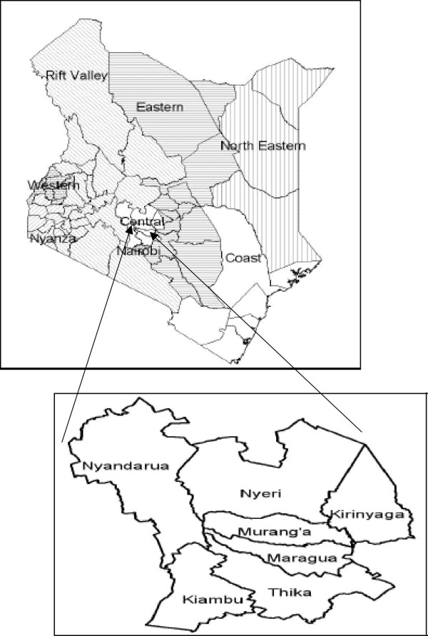
The Central Region of Kenya is made up of five distinct counties these are Kiambu, Nyandarua, Nyeri, Murang’a, and Kirinyaga all served by postal codes ranging from 00000 to 10999 . This region, historically known as Central Province until Kenya’s 2013 devolution, covers 11,449 km² and hosts a population of more than 4.38 million residents.
Central Region at a Glance
| Regional Information | Details |
|---|---|
| Total Counties | 5 |
| County Names | Kiambu, Nyandarua, Nyeri, Murang’a, Kirinyaga |
| Postal Code Range | 00000–10999 |
| Regional Area (sq km) | 11,449 |
| Total Population (2009 census) | 4,383,743 |
| Regional Headquarters | Nyeri (historically) |
| Major Economic Activities | Coffee farming, dairy production, horticulture, light manufacturing |
| Primary Languages | Kikuyu, Swahili, English |
| Climate Zones | Tropical highland (cooler temperatures, bimodal rainfall) |
| Regional Postal Distribution Centers | Kiambu GPO (01000), Nyeri Main (10100), Kerugoya (10300) |
| Tourist Destinations | Aberdare National Park, Mount Kenya slopes, Gura Falls |
Regional Administrative Structure
All the counties in the Central Region fall within the devolved county systems, with national administrative oversight. The region itself is headed by a Regional Commissioner, appointed by the national government, who coordinates security and cross-country services. Meanwhile, the counties are run by elected governors who manage county-specific functions.
Administrative-wise, the cities in the central region of Kenya are sub-counties further subdivided into wards that align with Constituency boundaries.
Central Kenya Postal Codes
All the central region counties, Kiambu, Nyandarua, Nyeri, Murang’a, and Kirinyaga, have postal codes managed by the Postal Corporation of Kenya (PCK).